Status of National Research Projects
(1) 2026 - 2030 (Ministry of Climate, Energy and Environment) Al-Physics Hybrid Flood Prediction Technology for Flood Warning Expansion and Climate Crisis Response
(2) 2025 - 2031 (Ministry of Science and ICT) Fundamental Research Program for Developing AI-based Future Climate Technologies
(3) 2025 - 2030 (Ministry of Science and ICT) InnoCore Program: AI-Transformed Aerospace
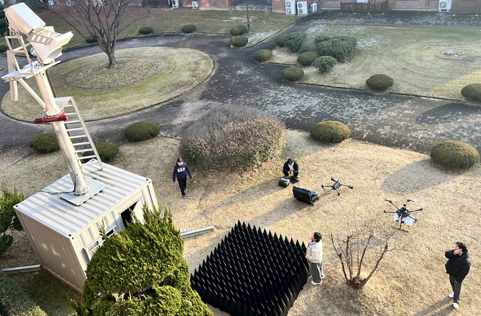
(4) 2024 - 2029 (Ministry of Science and ICT) Introduction of Passive L-band Radiometer Observation System to Improve the Accuracy of the Korean Numerical Weather Prediction Model for Agricultural and Forested Areas
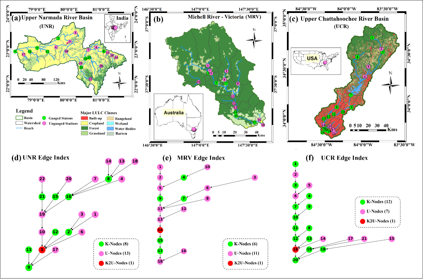
(5) 2025 - 2028 (Ministry of Science and ICT) Development of Early Warning Technology for Extreme Weather in Korea Based on AI Emulator-Numerical Weather Prediction Model Coupling: Utilizing GNSS-R Satellite Constellations and Water Resources Satellite
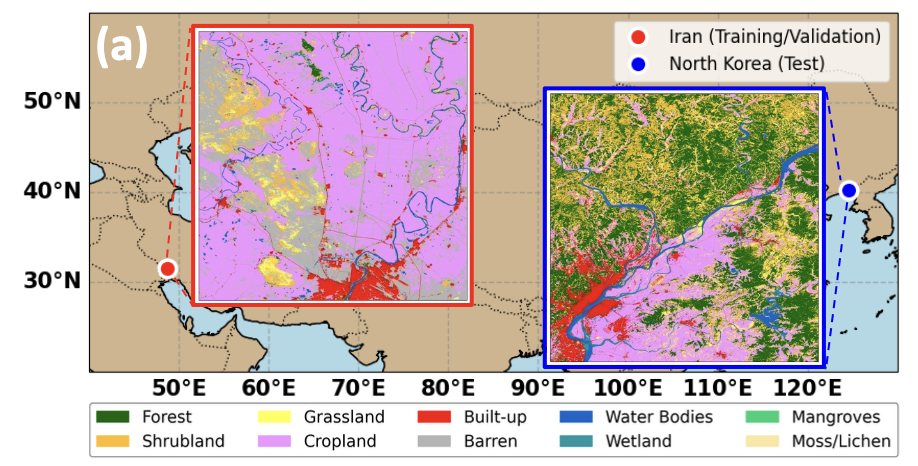
(6) 2025 - 2026 (Ministry of Science and ICT) Analysis of North Korea’s Climate Change Response Capacity Using Satellite Data and Development of a South-North Science and Technology Cooperation Model: Focusing on the Feasibility of Establishing Validation Sites
(7) 2025 - 2030 (Ministry of Environment) Graduate School Program for Specialization in AI-Circular Economy Clustering
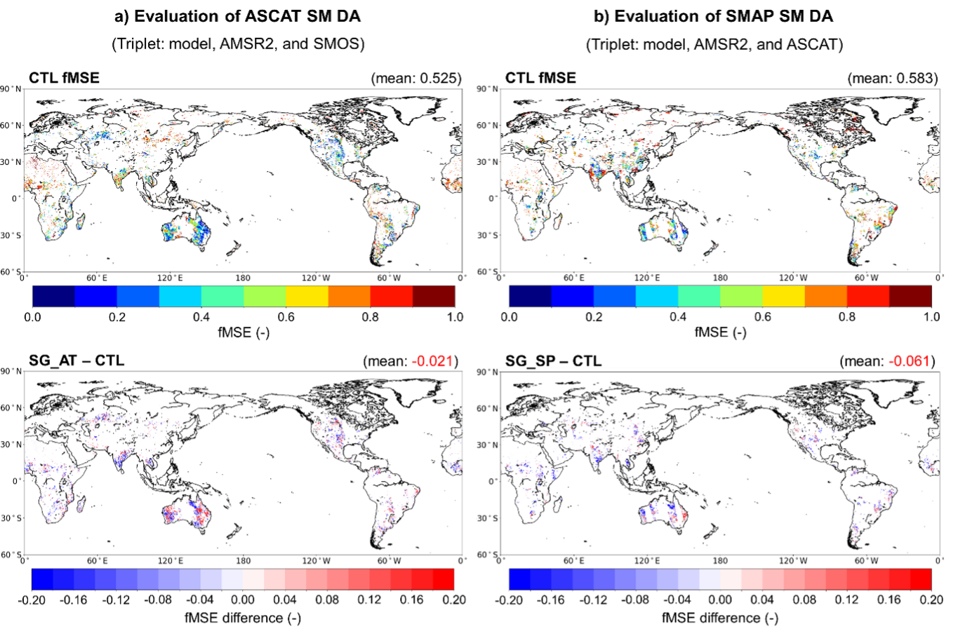
(8) 2025 - 2026 (Ministry of Climate, Energy and Environment) Development of A Technology for Estimating Spatial Rainfall Distribution Through Multi Source Microwave Satellite Data Fusion


If you have a keen interest in the intersection of climate change and its impact on hydrological research fields, I encourage you to consider pursuing a Master's, PhD, or postdoctoral position. By delving deeper into this critical area of study, you can play an essential role in addressing the world's most pressing environmental challenges and help safeguard our water resources, ecosystems, and communities. Your dedication and expertise can significantly contribute to the development of sustainable solutions and innovative approaches to hydrological research. Embark on this exciting journey and become part of the passionate community of scientists working towards a more resilient and environmentally responsible future.
